Do your readers know what/where you're mapping? Adding a small locator map can help to provide some geographic context.
But in @TableauPublic, it is challenging to scale maps accurately... One option is to draw a shape in @QGIS...
This is #RandomQGIStoTableauStuff #17! 😁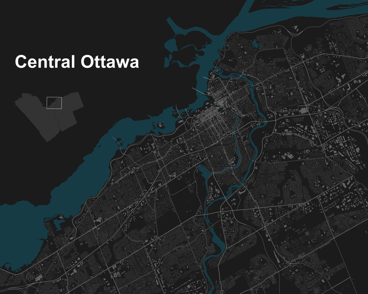
With @QGIS, we can create vector layers of points, lines & polygons.
In this case, I want to create a temporary POLYGON layer. And then using the digitizing & shape digitizing tools, I can draw a rectangle e.g. around the central part of Ottawa & save this layer as a shapefile.
In @TableauPublic, you can then add this rectangle as another map layer, to be used as: 1) an extent indicator on the locator map; and 2) a guide to scale the main map.
You can also switch the maps (small↔️large) to create an inset map.
Thanks so much for reading! 🙏

Dennis Kao
@professorkao
Ramblings about maps, data visualization, Tableau Public, QGIS, etc. Social Work Professor by Day Data Viz & Map Designer by Night